Greenway Trail Master Plan

Dawson County Greenway Trail Master Plan
Unlike many communities, Dawson County is planning for trails and greenways ahead of/during
booming development and growth, not after the majority of the land is developed. There are easily
identified places where trails need to connect and now is the time to start the process of connecting
the dots with planned routes. Existing topography and proximity to water adds challenges to the
process, but they also create interest and beauty in the system.
Many of the greenways proposed in this plan rely on the acquisition of right-of-ways and
easements through privately owned lands. The routes shown in the proposed master plan utilize
existing and planned utility easements and/or roadway right-of-ways to the greatest extent
practical. For portions shown through undeveloped properties, the route should be refined with
detailed design to accommodate future development plans for the property.
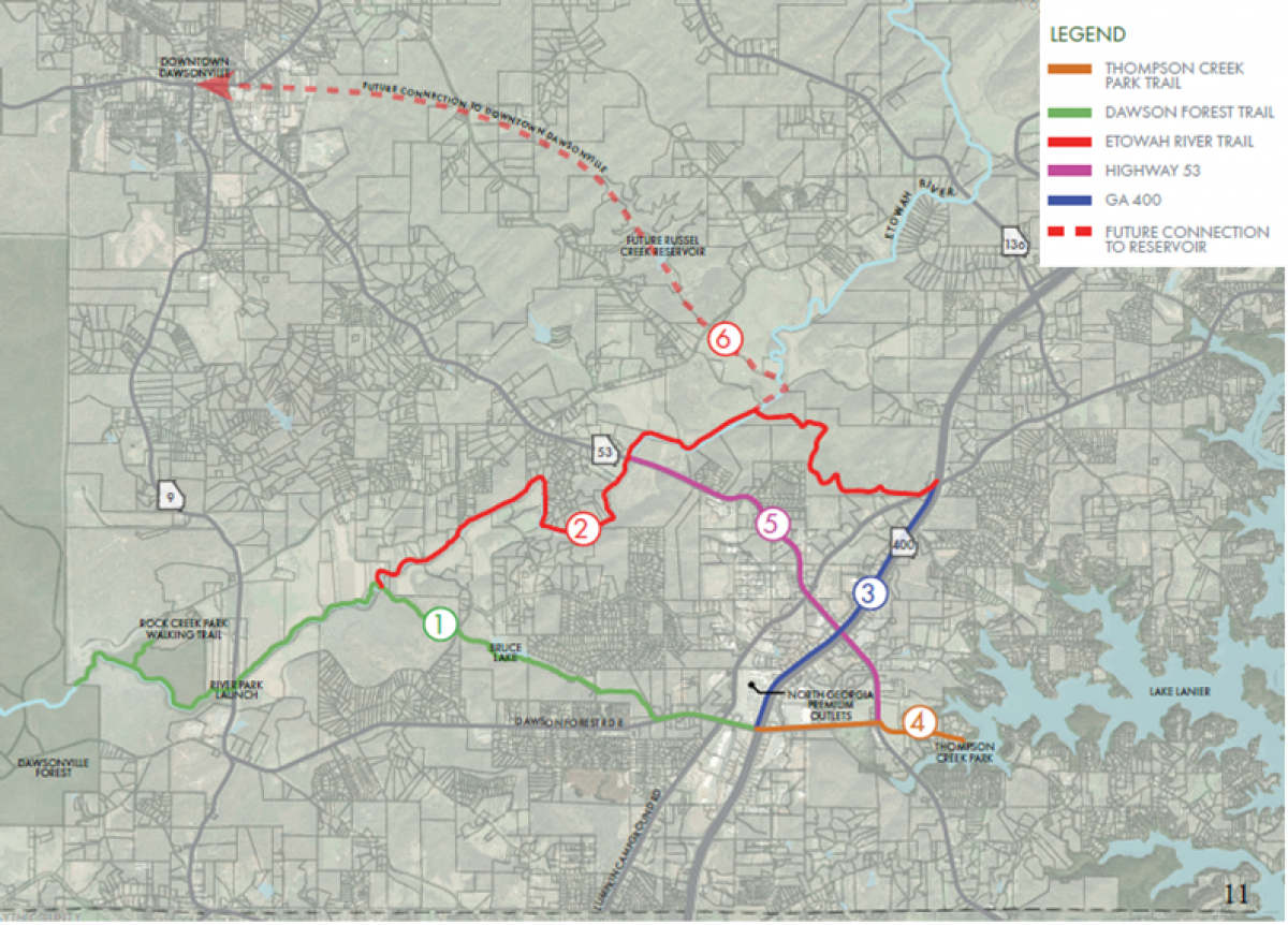
This plan identifies approximately 19.6 miles of trails in southern Dawson County, connecting
schools, parks, Lake Lanier, Dawson Forest, neighborhoods, employment areas and the Highway
400 retail and service destinations. Future expansion of the trail system should include connections
to Russell Creek Reservoir, Downtown Dawsonville, Amicalola Falls State Park and other
greenspaces and protected areas.
To be successful, the 19.6 miles of new trails will require significant time and monetary investment.
But upon doing so, the County will reap benefits that will be enjoyed for generations to come.
These projects should not be looked at as simply addressing a recreational need. Instead, the well
connected trail system will address transportation infrastructure, economic growth investment and
many other community needs.
Click the files below to read the complete Greenway Trail Master Plan


